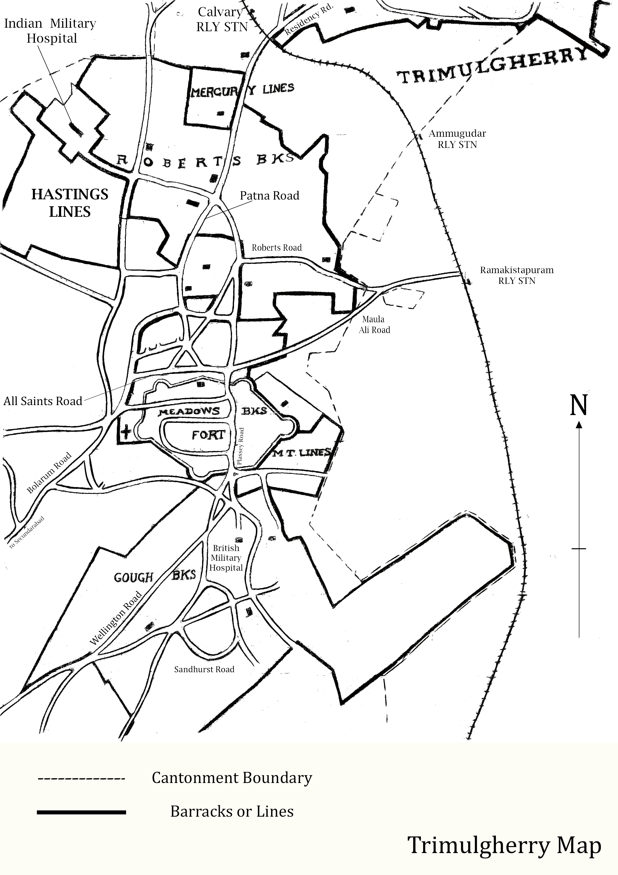
Dr. Yamini C. Krishna approached me to make some printable maps for some of their research work for their book “Film City Urbanism in India”. The research, as far as I saw it, was about tracing the history of cinema halls in Hyderabad and they needed to
- Recreate some older historical maps to a printable format as re-drawn images
- Create newer OSM-based retrospective maps that marked these halls by decade in a readable format. The challenge was to create a visually appealing and informative map that highlighted cinema halls with labels, specific localities like Abids, Musheerabad, and Khairatabad. The centerpiece of the map was Hussain Sagar, a landmark that helps orient anyone familiar with Hyderabad to the map.
The Mapping Process
Step 1: Stylizing the Map in Mapbox
The first step involved using Mapbox, a powerful tool for custom map design. The objective was to simplify the map for readability. This was achieved by:
- Colour Stylisation: Choosing a colour palette that was clear yet functional.
- Hiding Unnecessary Layers: Removing layers that cluttered the map, such as minor settlements, road names, and highway icons.
- Filtering Specific Features: Ensuring that important features like Abids, Hussain Sagar, and the Outer Ring Roads were prominently visible.
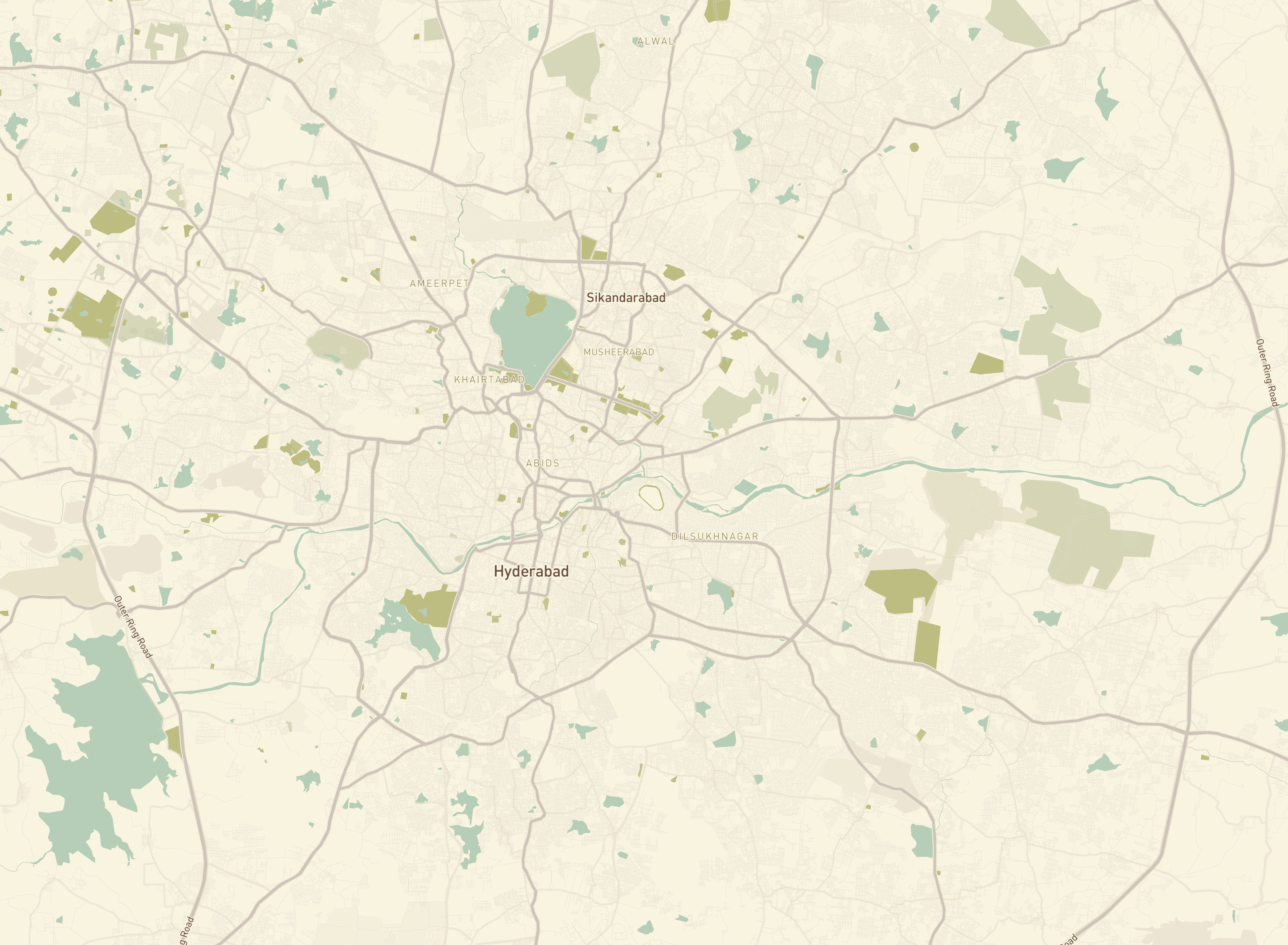
Stylized basemap in Mapbox
Step 2: Exporting and Georeferencing
Once the map was stylized:
- Export as PNG: The map was exported from Mapbox as a PNG file.
- Georeferencing in QGIS: The PNG file was then imported into QGIS, a free and open-source geographic information system, where it was georeferenced to align with geographical data accurately.
Step 3: Enhancing Map Details in QGIS
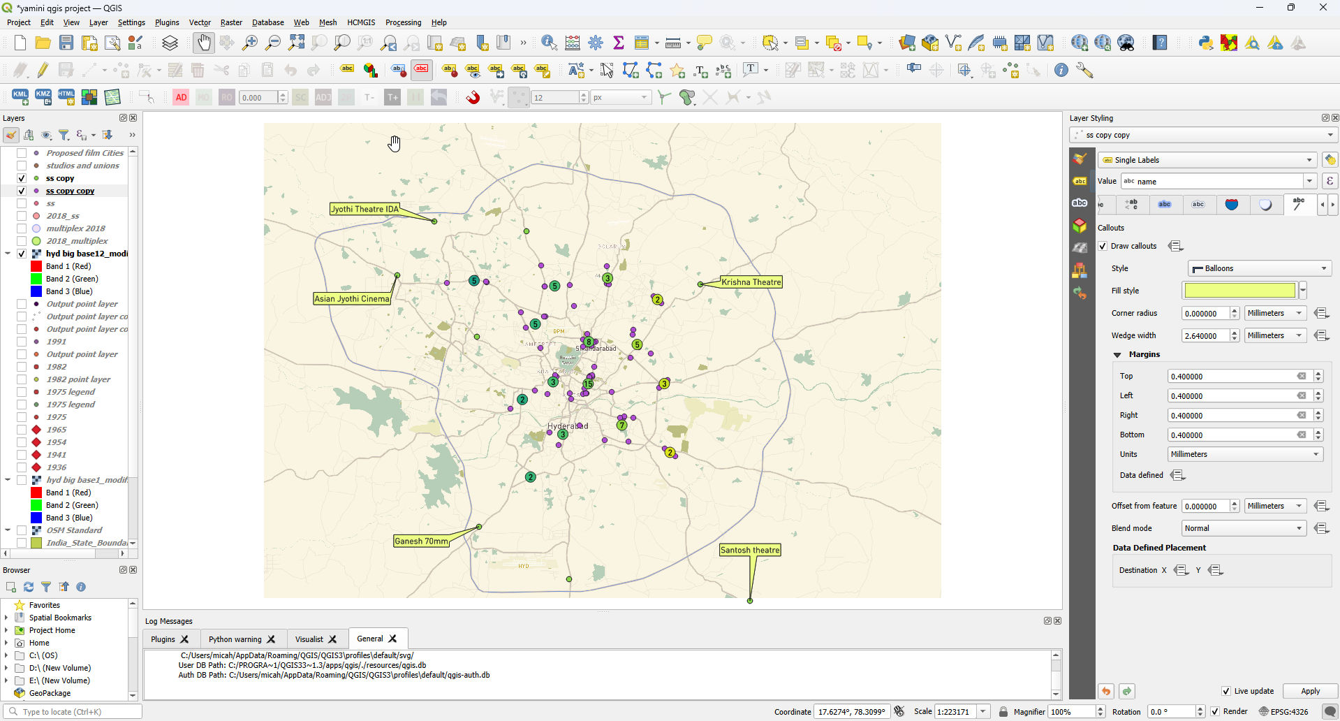
In QGIS, further enhancements were made:
- Stylizing Labels: Labels were styled using callouts and offsets to improve visibility amidst a high density of points.
- Manual Adjustments: Labels were manually adjusted to avoid overlap and ensure clarity.
- Creating a Layout: A layout was designed, incorporating a scale and map title for professional presentation.
Step 4: Final Touches in Inkscape
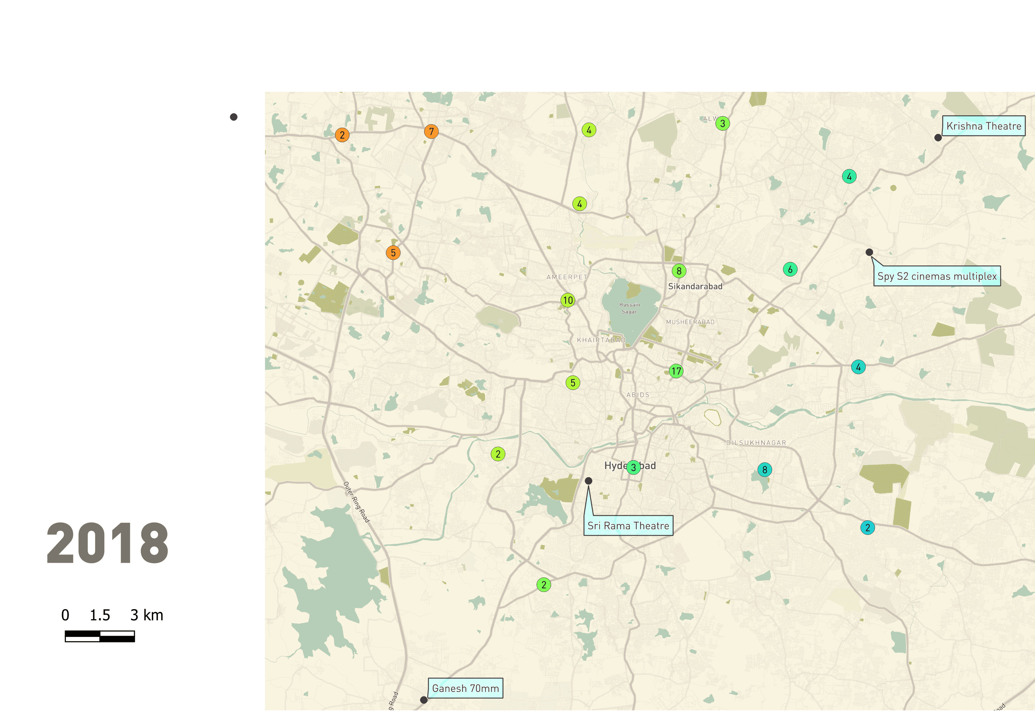
The map underwent final refinements in Inkscape, a vector graphics editor:
- Importing the Map: The QGIS-exported PNG was imported into Inkscape.
- Adding a Legend: For labels that could not fit directly on the map, a legend was created to accommodate them, ensuring no information was lost.
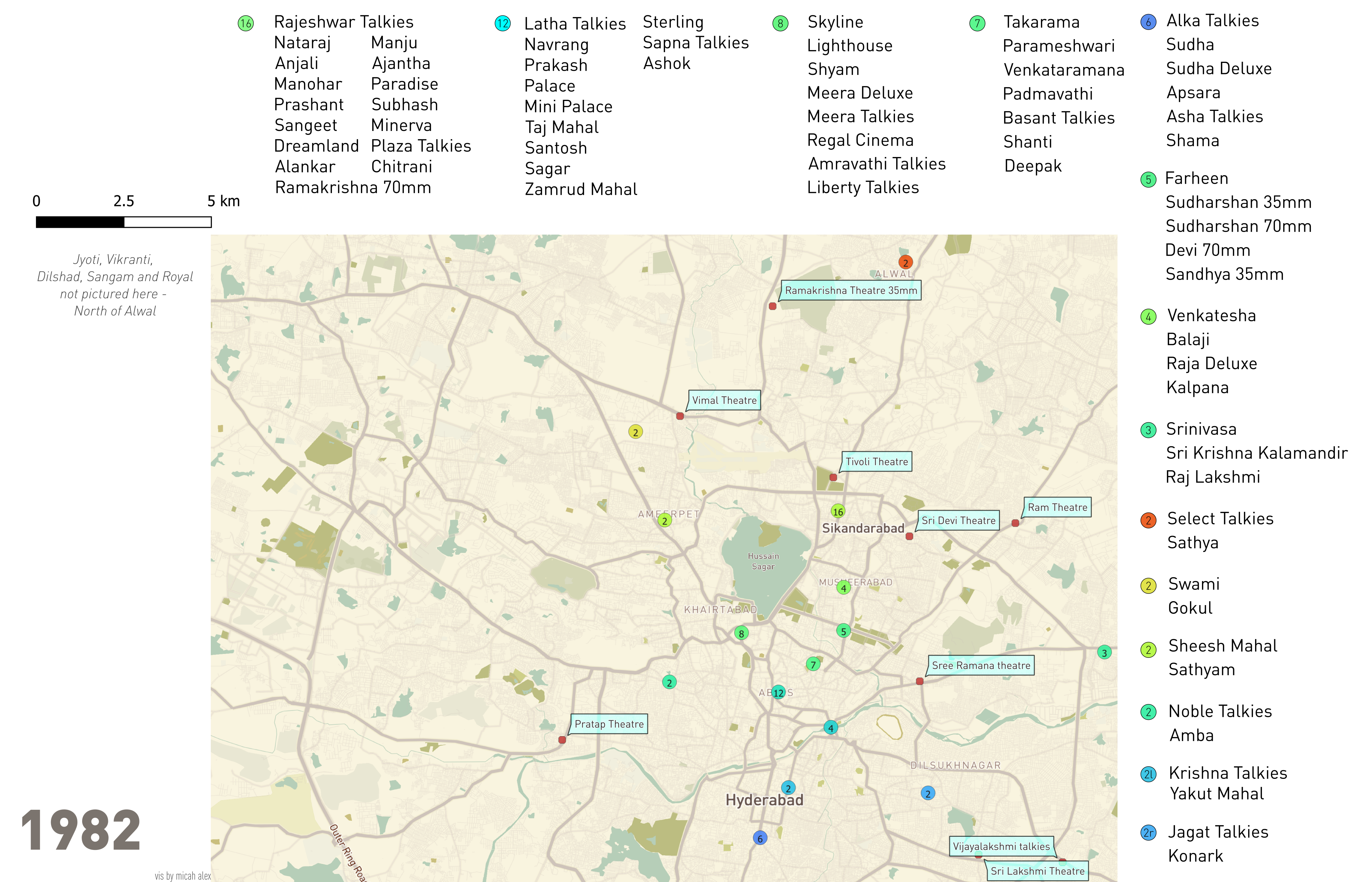
Final Layout in Inkscape
Other Maps
A few like this one was redrawn in Procreate using a Telangana State Archive map that Dr. Yamini discovered